...the commissioners [in 1804] felt compelled to apologize for having halted at 155th Street. The reason "the whole island has not been laid out as a city," they explained, was not from any lack of expansionary will...Going farther would simply have been pointless... because "it is improbable that (for centuries to come) the grounds north of Harlem Flat will be covered with houses..."
Edwin G. Borrows and
Mike Wallace
Gotham
1999
The physical transition from the nineteenth century to the twentieth century was one of the most vivid in New York history. As a whole section of the city like the Upper West Side changed its contours, it was like a great geological event...Dynamite blasts rocked the neighborhood, shaking houses and scaring horses in the street. Broadway opened up like a fault... there were yawning pits in the bedrock, created by the vast excavations necessary for the foundations of the new, oversized buildings. Elizabeth Hawes
New York, New York
1993
The morning had advance but a few hours before [George] Washington was again afloat with Green, Putnam and Mercer... Rowing briskly across the [Hudson] River, the Generals landed, probably lower down towards 158th Street, where a little stream descended from the hillside through what is now Audubon Park, and ascending the hill, they made for the Headquarters House, the later Jumel Mansion...
Reginald Pelham Bolton
Washington Heights
1924
155th Street
Just before you reach 155th Street, you will pass Audubon Terrace. You can return for a full examination of this unique museum complex at the end of your walk, so for now, continue to 155th Street, which is the southern border of Audubon Park, as well as the official southern border of Washington Heights.
In the early 1800s, New York’s aldermen realized that the city was growing rapidly and that they needed to manage that growth. After several false starts at the city level, the state legislature assumed the project and appointed a commission, which in turn created a plan.
The commission hired John Randel, Jr to survey Manhattan as far north as was necessary to accommodate the projected population growth for the next several hundred years. When the Commissioners Plan Map appeared in 1811, 155th Street was the northernmost street, though like most of the streets above 14th, it only existed as a straight line drafted on a map. Incidentally, by 1911, New York City had grown well past 155th Street, a couple of centuries ahead of projections.
Clues to the past
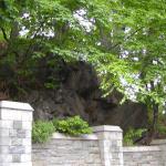
Look across the street at the cemetery. Notice the difference between the cemetery’s elevation, which closely approximates its 1842 topography, and the street’s, which has been graded. This view of the cemetery will give you a sense of the rocky, uneven terrain that dom-inated Minnies Land (and Audubon Park) until nearly incessant blasting in the early 1900s, excavations for the subway and apartment-building foundations, created the relatively smooth streets and sidewalks that we travel today.
Battle of Fort Washington
Before you continue down 155th Street, look south along Broadway to the end of the stone wall. In November, 1776, at the beginning of the American Revolution, that spot marked the “second line of defense” erected by the Continental Army. In September, after the Battle of the Heights of Harlem, which was fought south of here around 120th Street, Washington evacuated most of his troops to New Jersey. About 2,800 men remained under Nathanael Greene to defend Fort Washington. Washington thought the position was indefensible, but Greene refused to abandon it.
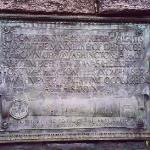
On November 16, 1776, the British attacked from the south, pushing the lines of defense back into the fort, and then from the north, overcoming the fort completely. With that battle, the British took control of Manhattan for the duration of the revolution. A plaque on Broadway and 153rd Street, at the southern side of the cemetery commemorates that November 1776 battle.
 | ||||
 | ||||
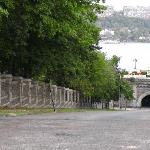
Looking down 155th Street
from Broadway
(click to enlarge)
Audubon Park Apartments
Advertisement 1906
(click to enlarge)
Trinity Cemetery's Original Topogaphy
(click to enlarge)
 | ||||
Continue your walk . . .
Funded by the Audubon Park Alliance


